 |
| An early morning shot before leaving one car here |
The first two miles from Normanton Car Park on Rutland Water were very simple - follow the yellow brick road, well, the tarmac path, past the café, past Normanton church and the back entrance to the Normanton Park Hotel, and carry on across the dam. Blue sky, blue water, and a chilly north wind. A few cyclists, loads of sheep and the guys inflating those see-through balloons you can be strapped in to roll down the grassy slope behind the dam.
Instead of going through the gate at the end of the dam path, we followed the field edge round, almost turning back on ourselves. We walked along the edge of the wooded area, and shortly after a couple of trig points, or similar objects, there was a stile on our left which led into a field. We spotted the Rutland Way signs for the first time today - and on the stile.
 |
| Ten out of ten for clarity! |
Just after the end of the village, very soon after Mill Lane, the footpath goes away from the road, up through a short stretch of woodland - Chapel Spinney. A little further along the road after the turn there's a convenient bench for our first stop of the day - a little chilly in the shade, so we didn't linger longer than the few minutes needed to top up the caffeine level.
The path came out of the trees into sunshine and continued along the top edge of several fields. Empingham was now a cluster of houses and the church behind us. We passed a spinney on the right, and continued to follow the path. There may be a waymarker that we missed, but we fought our way thorugh an overgrown section and came out on the concrete path leading towards Tickencote Lodge Farm. We had just walked round the two sides of a triangle instead of the hypotenuse - give or take the accuracy of the right angles.
 |
| Tickencote Lodge Farm |
We followed the signs round the house and on to a small road north east for a short distance, before entering a couple of fields and walking in the same direction, the turning slightly to the right.
 |
| Tractor tedding hay near Tickencote |
He seemed to be dozing in the shade and showed no interest in us.
 |
| Looking towards Tickencote Hall |
 |
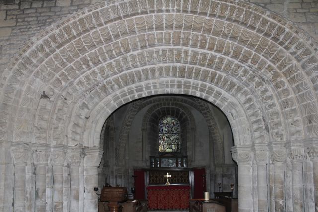
| The vaulting |
 |
| The chancel arch |
 |
| The East End of the church |
Chatter, imperfect map-reading and inattention to the book's instructions almost set us off on the wrong road after lunch - and all on fruit juice at that.
You need to walk along to the junction with the Pickworth road, and turn left past the primary school - or take the narrow lane between houses just before the school sign on the main road. In any case take the road out of Great Casterton past the school and walk along this for a good mile until you reach Mounts Lodge Farm. Opposite here a bridleway leads to the left - almost due west. The path was pretty muddy - puddle-dodging skills honed while you walk.
After a few hundred yards, at the end of the first very big field, we turned right along a grassy track. We continued along this, ignoring any tracks to the right or left, and made our way more or less north towards Pickworth. The signing around here is pretty poor. Just opposite the point where the path meets the road is this medieval arch.
 |
| Photograph 24.11.2011 |
The arch, on private land is all that remains of a church from the 12th, 13th or 14th century.
 |
| The remains of a lime-kiln, where John Clare worked for a while as a lime-burner - photo 18.11.2011 |
We turned left along the road, and walked past the first footpath sign near Manor Farm, and past the limekiln, to find the path we needed, which goes off to the right at a bend in the road. Time for another coffee-break, before tackling the remaining three or four miles.
The path is wide and clear, and we had no trouble finding the point where we turned left across a field towards a strip of woodland marked as Little Sutie on the map. Through this was where I had wandered last time i walked here. The map shows the path diverging slightly from the wood on the right hand side. This time we followed the edge more closely and we found the path through the quarry with no difficulty. Once at the quarry the bridle way is clearly posted.
 |
| Clipsham Quarry 24 Nov 2011 |
We walked along the Castle Bytham road for about a mile to get back to the Yew Tree Avenue. Fourteen miles on the clock today.
Map and details


