Saturday, September 29, 2012

An overview

The pond in Barrowden


An overview of the entire route
As suggested in the book.
We began and ended at Braunston in Rutland and it took seven separate walks to cover the whole Round.

1. Braunston to Uppingham
2. Uppingham to Seaton
3. Seaton to Barrowden - a very short walk
4. Barrowden to Normanton
5. Normanton to Clipsham
6. Clipsham to Whissendine
7. Whissendine to Braunston.

Friday, September 28, 2012

Day 7 - Whissendine to Braunston

With Marta. Started grey and drizzly, but after Langham (11 am) it cleared up for the rest of the day. Still some mud underfoot, views good. 11.7 miles approx. A few hilly bits.

We set off from Whissendine around 9 30, and walked up past the church,  turning right on to Foxhills, and following the road round as far as Number 21.  The footpath runs alongside this house to a field, where we turned left.  There's a gateway on to the the road, but the path turns right and follows the hedge for a short distance before joining the road at a stile. We turned right along the road as far as a left hand bend.  At this point we continued straight ahead, on a bridleway leading to Langham.

By now we were both wearing waterproofs as the drizzle persisted. The hedge was on our left for a while, but at the summit of the track it changed to being on our right.  The views here are said to be excellent, but the mizzle made them a little hazy today.  We used John Williams' book and the OS map and found the path without problem. At one or two points along the way the waymarks have faded or become overgrown.

There is a junction of bridleways at the end of the field, and here we turned right, with the hedge on our left.  In the next field the path goes over a stile after a gap in the hedge on the lef. We followed the path alongside a deep ditch on our left.  We crossed a plank bridge and then turned right when a hedge blocked the way, turning left over a briidge in a short while cutting off the corner of a field before following the hedge and waymarkers to reach Manor Lane in Langham, via a stile.

We turned right then left into Orchard Road, then at the end of Orchard Road, right then left into Bridge Street.  Just after the bridge we turned right before the Noel Arms. 
5 stars for the welcome coffee!


Well, to be truthful we were delighted to be able to buy an early coffee in the pub - the landlord took pity on our drowned rat appearance.


The rain gods smiled on us and by the time we left twenty minutes later the rain had stopped. 


At the end of Church Street we crossed the main road, turned right for a short distance before taking the bridleway towards Braunston, which leads off to the left.  The path climbs up hill following the left hand hedge and turning right to walk around the small wood near  Mill Hill.

At the end of the wood we turned slightly right and continued up to Manor Lane, a small road which leads into Barleythorpe.
Rutland Water in the distance
We walked down into Barleythorpe, and to the road, then turned right, along a pavement until a stile led into a playing field on our right. After this we walked along the edge of Catmose College, and through Rutland Care Village, before coming out close to the level crossing near Oakham Station.

We had our lunch stop at the Castle Café in Oakham - a very good broccoli and stilton soup.  It was still a little cool and damp for sitting out.
Outside the Castle Café, Oakham
We left Oakham on the road towards Uppingham and Kettering.
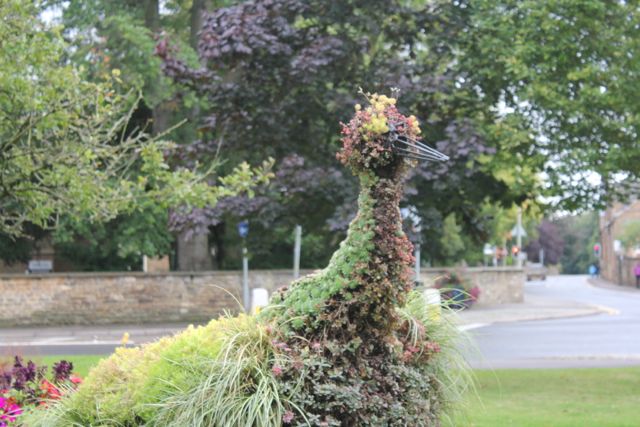
Floral peacock
Swooning Bridge, from where you could see the gallows at the top of the hill.
Shortly after the bridge our path turned off to the left towards Egleton, crossing muddy fields which could have been a lot worse!  Of course, since the 2000 edition of the booklet, and the publication of my OS map, the bypass has been built.  It's on the newer maps, and doesn't complicate the route.

Through Egleton, we turned right along the road to the A 6003.  We crossed over the road and then the railway line to a path which leads up hill with a hedge on the left.

 At the second gateway we cut across the field slightly, joining a track past Brooke Covert East.  Soon after this the track bears right, but we took the route through a gate to the left.  The path goes downhill over a small bridge and past Bridge Farm into Brooke. 
Brooke Church
We walked through Brooke, turning right at the junction.  We passed some earthworks on our right, and a dovecote in the grounds of Brooke Priory - a house on the site of a 12th century priory.
Earthworks at Brooke
The dovecote
We took a footpath in the field opposite the priory, and walked alongside the stream, the Gwash.   After a few hundred yards the path crosses a footbridge to a bridleway.  We went across the bridleway through a gateway and over a field diagonally to the left hand hedge. The path is clearly marked into Braunston. 
The last few steps of the Rutland Round

with a little more decorum

and a feeling of achievement.
And here is Braunston Church again 

65 miles of very enjoyable walking, done on seven separate days.  


Map and details

Sunday, September 23, 2012

Things don't always go to plan!


The walk that wasn't

Ever seen the 1970 film Out of Towners? Jack Lemmon stars as a guy from Ohio going for a job interview in NYC.  His well-laid plans to indulge his wife with a room at the Waldorf and a gourmet meal the night before gang very aglae as fog closes the airport in New York and the plane diverts to Boston. And that's just the start of their woes.

I watched the film on Wednesday night, and felt I was living a, thankfully, tamer version on Friday. 

We were going to walk about 11 miles, starting around 9.30. With luck we'd have a decent walk before the forecast rain began in the afternoon.   Crossed wires - well misunderstood emails - screwed up our meeting point, but hey this happens, and luckily there was Benjamin Grosvenor playing the piano on Radio Three, so I wasn't fretting.    

We eventually met up, and I was driving quite happily along a narrowish country road, when some nameless unknown character drove a little too close to me and with a flamboyant bang destroyed my offside wing mirror.  

Hell - we needed some coffee now, so a change of plan took us into a convenient garden centre café.  No problem and it was past 10 am, so I was up for my caffeine shot.  The lack of a wing mirror was niggling though - it's quite possible to drive without it, but takes some getting used to. 

Second change of plan - we headed to Oakham to see if anyone could fix it. As they couldn't we parked the car, kitted ourselves out in walking gear - boots, backpacks, maps dangling from our necks, the works. You can guess the next thing - the rain turned up on time and settled in for the day.


Here is Hudson's life story as a royal favourite, then as a slave in North Africa, his return to England, and later imprisonment as a Roman Catholic traitor.
So, a mile round Oakham, lunch and a return home.  As we walked back to the car, someone smiled cheerfully and said, "Not much of a day for walking, is it?"  Little did he know.


Oakham's butter cross and stocks

Oakham Castle - Great Hall

Saturday, September 8, 2012

Day 6 - Clipsham to Whissendine 7 September 2012

With Marta. Fine, sunny, very warm. A few dry ploughed fields to cross. garmin fail between Teigh and part way to Whissendine - human error. About 13 miles in all.
The first part of this walk was a little uninspiring - along the road from Clipsham to Stretton, though we discovered that we could have walked a little further from the verge, too late for today.  

We followed the road to the roundabouts under the A1.  Our path left the slip road for the A1 North, via a plank bridge and a stile.  


The route lies across a large grassy field, and crosses a concrete track, then another bridge and field before joining a minor road.
A very free range hen
At the road we turned right and walked up to the bend in the road, where a path goes to the right.  At this point we had some difficulty, and lost the waymarks.  When we came out at the road as the map route showed, we were still unsure, and diverted slightly to join another path which took us back to our route more easily. 

This was near the flight path and approach lights for RAF Cottesmore.  This is now known as Kendrew Barracks.  

Soon after crossing the old flight path, we had a quick break, before following the route into Thistleton. John Williams's book and the waymarking helped make this straightforward.

Thistleton, the most northerly village in Rutland, is very small, but has a fine church and a herb farm.
St Nicholas church, Thistleton
From Thistleton, we took the road west towards Sewstern - and carried on until we reached the point known as Thistleton Gap, where Rutland meets Lincolnshire and Leicestershire.

From wikipedia:
On 28 September 1811 a massive crowd of up to 20,000 watched a prizefight at Thistleton Gap. Tom Cribb fought the American Tom Molineaux in a hotly contested re-match for the heavyweight championship of England. The match was a matter of national pride and the names of both these men were famous throughout the land. The venue was chosen as the three counties of Rutland, Leicestershire and Lincolnshire met there and if the police arrived to halt the illegal fight the boxers and crowd could escape across the county boundary. In the eleventh round Cribb knocked out Molineaux. The original match, a year before, had ended in exhaustion for both men after a gruelling 33 rounds with accusations of cheating. During the intervening period both men had lost weight; Cribb because of extensive training with the famous Captain Barclay and Molineaux due to loss of muscle whilst earning his keep at local prizefighting venues.[7]
We recognised the spot by the county boundary sign, and two large barns on the left hand side of the road.  
The barns near Thistleton Gap


Shortly after the barns we had to cross another ploughed field, diagonally right to the corner of the hedge.  After this it was a case of following the path and waymarks along field boundaries.  With the hedge on our right we could see a house - Cribb's Lodge, which is reputed to be the training base for his bare-knuckle fights. 

We continued with the hedge on our right, ignoring a path and stile on the right. We had to turn left then right with the field boundaries, joining a farm track just before a small industrial estate on our left.  We carried on skirting some woodland, still with the hedge on our right.  As we were on the south side of the hedge for most of the time, this was hot going, and the views weren't up to much for a while!  We had another break when we found a suitably shady spot - at last.
Just after walking past the wood there is a shadier path, with wider views -  quite a relief!

We turned left and later right around the wood's edge.  The path is crossed by a path towards Edmondthorpe.   We had to turn left at a point where a bridleway goes straight ahead. 
Use the book and the OS maps here - much clearer than my description!
At the end of the last field is a gate, near the disused Melton to Oakham Canal. The track goes over the canal.
The disused Oakham to Melton Canal
As instructed we headed slightly to the right across the field to a gate in the right hand hedge.   This led on to a track. When the track met the road, opposite Catmose Lodge,  we turned left towards Teigh. (TEE?) but no tea :-(.

We walked past a road to the right signposted to Whissendine, then just after the Teigh sign we turned right into the village and on to the imposing church.  It wasn't open at the time, so that'll be one for another day.


Holy Trinity church, Teigh
The path leaves just over the road opposite the west end of the church.  The waymarks are easy to follow here - there's even one on its own in the middle of the first field.  We went quite close to an area of water and saw two herons flying from there.   A footbridge and a stile, then a longish section with the hedge on our left was next, leading to this rather long thin footbridge:


Not quite a rope bridge over a chasm, but . . .
After this we took the path diagonally right across a field and through a gateway in the opposite hedge. We emerged on to a bridleway, turned right and then crossed the Leicester-Peterborough railway line.  You can see for a fair distance each side,  and judging by the train which came along soon after we'd crossed, you can hear the trains coming.
'Pill-box' remnant of World War 2 defences

Our path was along the bridleway for a good mile gradually uphill until it met the road to Whissendine.  We turned left, and in a couple of hundred yards took a footpath to the right, over a stile.
Whissendine windmill, seen from the path


We crossed the field to the stile opposite and came out near St Andrews Church in Whissendine.

From here it was all downhill to the village centre, the shop for a sandwich and some liquid, and back to the circular seat round a tree on the village green, where we ate our rather late lunch.
Map and details

Friday, August 31, 2012

Day 5 Normanton to Clipsham - 31 August 2012

With Marta.  Fine, sunny, but cold to start with.  Some mud underfoot. Luckily I remembered the way through Clipsham Quarry.  Only other small problem was on the way to Tickencote where we missed a turn to the right, but were able to correct easily. Lunch at The Plough in Great Casterton. 14 miles including walk to Yew Tree Avenue.
An early morning shot before leaving one car here

The first two miles from Normanton Car Park on Rutland Water were very simple - follow the yellow brick road, well, the tarmac path, past the café,  past Normanton church and the back entrance to the Normanton Park Hotel,  and carry on across the dam. Blue sky, blue water, and a chilly north wind.  A few cyclists, loads of sheep and the guys inflating those see-through balloons you can be strapped in to roll down the grassy slope behind the dam. 

Instead of going through the gate at the end of the dam path, we followed the field edge round, almost turning back on ourselves.  We walked along the edge of the wooded area, and shortly after a couple of trig points, or similar objects, there was a stile on our left which led into a field.  We spotted the Rutland Way signs for the first time today - and on the stile.  
Ten out of ten for clarity!
The signs were easy to follow from this point, leading over fields and through some woodland, until the path emerged into Nook Lane in Empingham.  Nook Lane leads to the main A 606.  We crossed over to walk past the White Horse pub and along the road through the village.  The church was down a small road to the right as we walked straight on.

Just after the end of the village, very soon after Mill Lane, the footpath goes away from the road, up through a short stretch of woodland - Chapel Spinney.  A little further along the road after the turn there's a convenient bench for our first stop of the day - a little chilly in the shade, so we didn't linger longer than the few minutes needed to top up the caffeine level.

The path came out of the trees into sunshine and continued along the top edge of several fields.  Empingham was now a cluster of houses and the church behind us.   We passed a spinney on the right, and continued to follow the path. There may be a waymarker that we missed, but we fought our way thorugh an overgrown section and came out on the concrete path leading towards Tickencote Lodge Farm.  We had just walked round the two sides of a triangle instead of the hypotenuse - give or take the accuracy of the right angles.


Tickencote Lodge Farm
We turned right and walked down the track until we met the Rutland Round waymarker pointing back to where we should have walked.  Close by was a stile into the next field of recently cut hay, which we crossed diagonally (just south of east) to the next yellow post just before another farm house.  

We followed the signs round the house and on to a small road north east for a short distance, before entering a couple of fields and walking in the same direction, the turning slightly to the right.
Tractor tedding hay near Tickencote
We crossed another small road towards Tickencote Hall, and had to brave this signposted danger:


He seemed to be dozing in the shade and showed no interest in us.

Looking towards Tickencote Hall
The path goes past the church of St Peter, which is small but impressive. It was restored at the end of the eighteenth century, but is considered a fine example of a Norman church.
The vaulting
The chancel arch
The East End of the church
We walked through the village to a sign and short section of path which crosses a field, then emerges on to a road near the OK Diner, then goes under the A1 and into Great Casterton.  The Plough Inn is right on the route and provided an adequate, though not perfect lunch, with exceptionally friendly service from its new landlord. 

Chatter, imperfect map-reading and inattention to the book's instructions almost set us off on the wrong road after lunch - and all on fruit juice at that.

You need to walk along to the junction with the Pickworth road, and turn left past the primary school - or take the narrow lane between houses just before the school sign on the main road.  In any case take the road out of Great Casterton past the school and walk along this for a good mile until you reach Mounts Lodge Farm.  Opposite here a bridleway leads to the left - almost due west.  The path was pretty muddy - puddle-dodging skills honed while you walk.

After a few hundred yards, at the end of the first very big field, we turned right along a grassy track.  We continued along this, ignoring any tracks to the right or left, and made our way more or less north towards Pickworth. The signing around here is pretty poor.  Just opposite the point where the path meets the road is this medieval arch.
Photograph 24.11.2011

The arch, on private land is all that remains of a church from the 12th, 13th or 14th century.
The remains of a lime-kiln, where John Clare worked for a while as a lime-burner - photo 18.11.2011
The lime-kiln is also on private land, and almost invisible in the summer. 
We turned left along the road, and walked past the first footpath sign near Manor Farm, and past the limekiln, to find the path we needed, which goes off to the right at a bend in the road.  Time for another coffee-break, before tackling the remaining three or four miles.

The path is wide and clear, and we had no trouble finding the point where we turned left across a field towards a strip of woodland marked as Little Sutie on the map. Through this was where I had wandered last time i walked here. The map shows the path diverging slightly from the wood on the right hand side.  This time we followed the edge more closely and we found the path through the quarry with no difficulty. Once at the quarry the bridle way is clearly posted.

Clipsham Quarry 24 Nov 2011
The path from the quarry towards Clipsham provided a few earlyish blackberries today. No problems following the route from here as for most of the way it runs between hedges,  and the village is clearly visible. 

We walked along the Castle Bytham road for about a mile to get back to the Yew Tree Avenue. Fourteen miles on the clock today. 


Map and details